
The European Space Agency polar orbiting CryoSat satellite has recorded a major loss of arctic sea ice. Scientists working with the European Space Agency (ESA) CryoSat-2 satellite have been measuring the Arctic sea ice extent for several years. CryoSat-2 carries a synthetic aperture interferometric radar altimeter in a highly inclined polar orbit that allows it […]
Time for United States Flagged Cruise Sh...

Incidents occurring within the cruise ship industry should give us pause over their safety and operational standards, begging the question: Is it time to require the use of United States flagged cruise ships in Alaska? Marine causalities take place every year with cruise ships, but the incidents with the Carnival Triumph, Carnival Splendor and Costa […]
Beaufort Wind Force Scale: A Mariner’s T
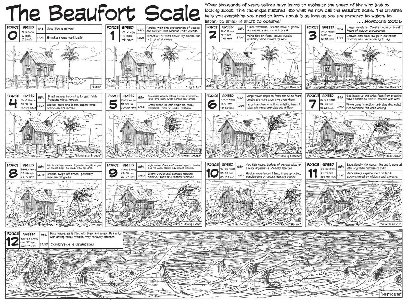
The Beaufort Wind Force scale provides mariners with a useful tool for estimating both wind speed and anticipated sea state in universally understood terms. In the lyrics of Billy Joel’s Storm we hear of the Beaufort Scale, “We’ve got a low pressure system and a northeast breeze. We’ve got a falling barometer and rising seas. […]
Historic Cape Spencer Light – Guarding t
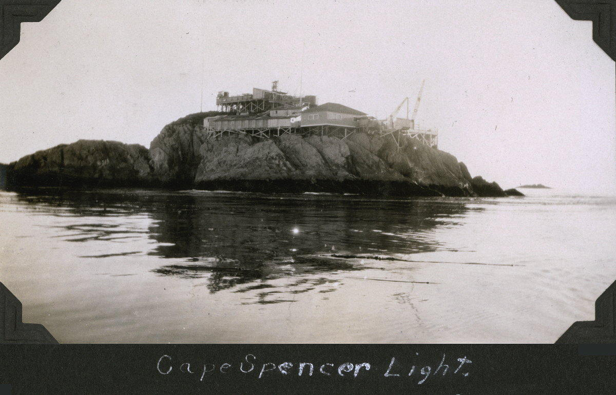
Historic Cape Spencer Light is located on Cape Spencer at the entrance of Cross Sound and Icy Strait from the outside waters of the Gulf of Alaska. It is found inside the boundaries of Glacier Bay National Park. Cross Sound marks the northern exit for vessels traveling along the Inside Passage of Southeast Alaska. The […]
Draft of Alaska Deep-Draft Arctic Port S...
The Alaska Department of Transportation and Public Facilities and US Army Corps of Engineers have released their draft report covering the first year of a three year study to enhance the deep-draft port system of Arctic Alaska. Port facilities in the north are minimal and range from simple gravel landings to extensive bulk mineral export […]
Handy Booklet Navigational Charts Availa...

The National Oceanic and Atmospheric Administration (NOAA) has developed and released a navigational tool aimed at the recreational boater. Known as BookletCharts, these nautical charts available for download and printing at home. Thousands of area charts from across the United States are available and Alaskan charts are well represented in the initiative. BookletCharts come as […]