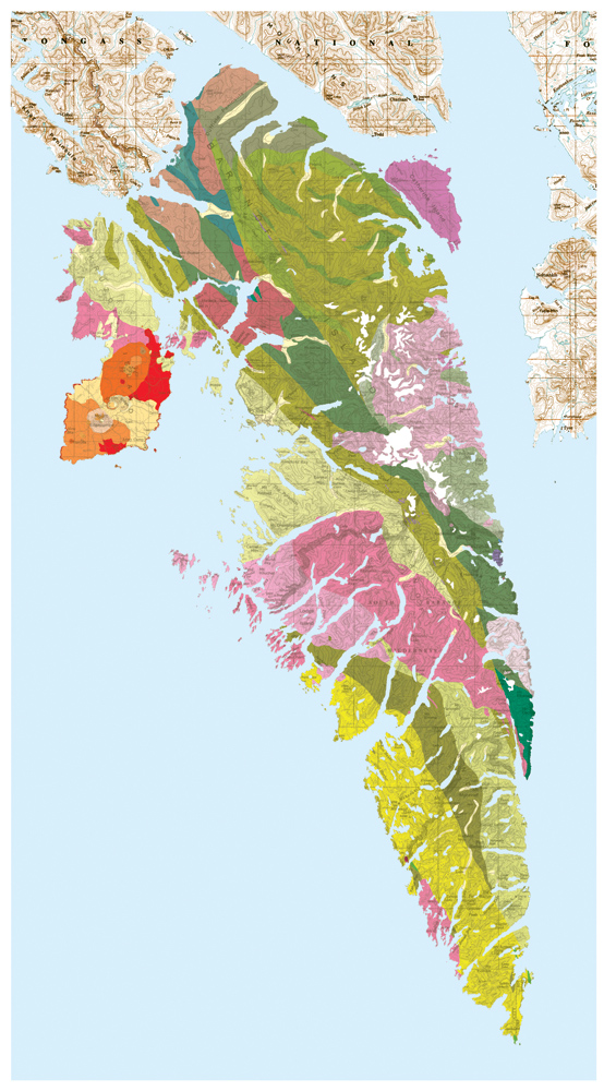
 Roughly the size of Delaware, Baranof Island in Southeast Alaska is the smallest of the ABC Islands (Admiralty, Baranof and Chichagof) Group. Home to the community of Sitka, these island is known for its Brown bear and Pacific salmon populations, temperate rain forest and extensive wilderness acreage. Recently the United States Geological Survey (USGS) published an updated geologic map of Baranof Island that details and displays its geological features.
This updated map and complementary pamphlet provides an overview of recent USCG studies on the island, provides detailed description of the rocks found there and depicts other geologic features found there like fault zones and hot springs. Researchers note that the island is geologically closer in its structure to Vancouver Island than other islands found in Southeast Alaska.
In a press release, USGS geologist Susan Karl says, “This report is a modern synthesis of new work and many years of topical investigations. Pulling together all of this information in one product is a benefit to scientists working on similar or related studies, and is of interest to the general public for explanations of local geologic features such as the Mount Edgecumbe volcano, the Fairweather, Chatham Strait, and Peril Strait Faults, gold deposits, and hot springs.”
While not everyone may have an interest in the geology of Baranof Island, this new map is interesting to view and provides details on the natural history of the region that could benefit the causal visitor to the island. The map and related pamphlet are available at the USGS Alaska Science Center site.