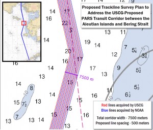
As the waters of Alaska see increasing use due to thinning ice, the National Oceanic and Atmospheric Administration (NOAA) has announced plans to conduct Arctic charting operations from Unimark Pass in the Aleutian Islands through the Bering Strait into the Chukchi Sea during 2015. Working with the Coast Guard to collect hydrographic data, the organization […]
Dramatic Arctic Sea Ice Thinning Seen in...
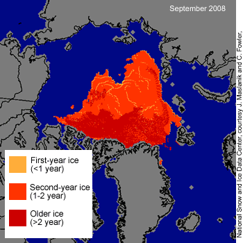
Researchers from the National Aeronautics and Space Administration (NASA) and the University of Washington Seattle have completed a comprehensive survey that shows dramatic Arctic sea ice thinning between the years of 2004 to 2008. The once dominant and thicker multi-year ice is being supplanted by thinner seasonal ice. Data for the study was provided by […]
PWS Escort Tug Winch, Towline and Tether...
As with many other coastal regions of the world, Prince William Sound in Alaska is utilized for the marine transportation of crude oil. Crude is delivered to Port Valdez via the Trans-Alaska Pipeline and shipped by ocean going tankers to ports along the west coast of the United States. After the disastrous grounding of the […]
Draft of Alaska Deep-Draft Arctic Port S...
The Alaska Department of Transportation and Public Facilities and US Army Corps of Engineers have released their draft report covering the first year of a three year study to enhance the deep-draft port system of Arctic Alaska. Port facilities in the north are minimal and range from simple gravel landings to extensive bulk mineral export […]
Lingering Oil from the 1989 Exxon Valdez...
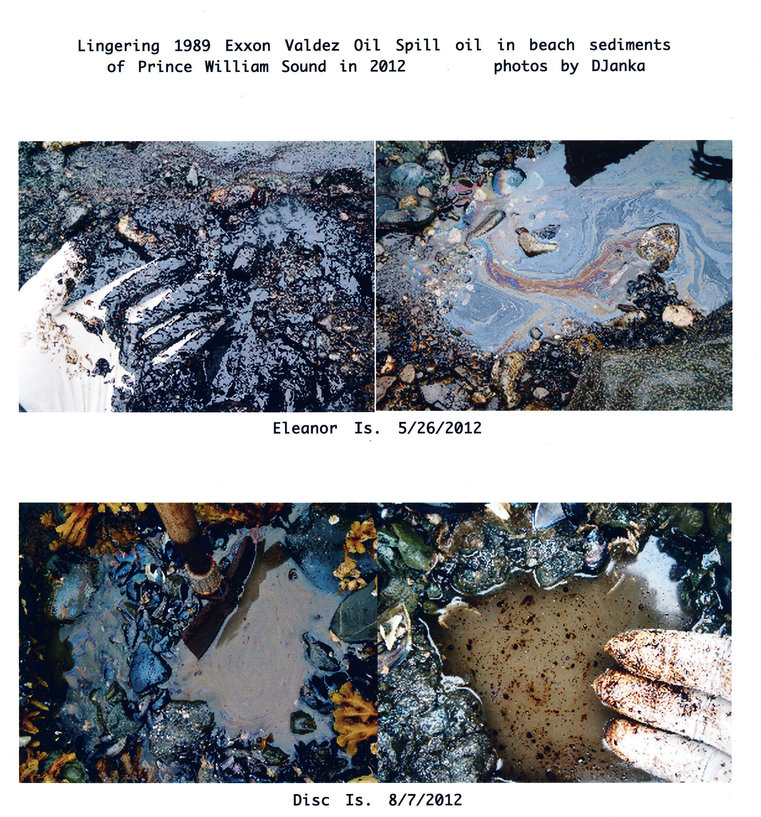
Lingering Oil from the 1989 Exxon Valdez Oil Spill Seen in 2012: As the issues continue with the Shell Alaska drilling unit Kulluk and Shell’s exploration efforts, it is important to remember than crude lingers for a long time in the arctic environment, heightening the importance of conducting exploration activities right the first time or […]
Arctic Nautical Charts Scheduled for Upd...

The National Oceanic and Atmospheric Administration (NOAA) Office of Coast Survey is planning an update of Arctic nautical charts. Nautical charts represent the traditional means mariners use to navigate coastal waters safely. The paper nautical chart reaches back into history with President Jefferson who commissioned the first surveys for charts in 1807. Paper charts vary […]